Beak presents S34I Horizon Europe project results at PDAC 2025,
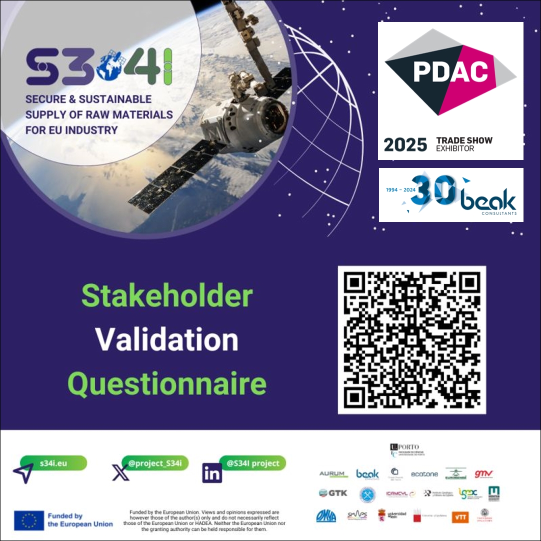
Invitation to participate S34I Stakeholder Validation Questionnaire
2nd – 5th March 2025, Toronto (Canada)
At the PDAC 2025 Convention, Beak Consultants is excited to presents its commercial services in the fields of geosciences, raw materials, GIS, IT, software development, AI, remote sensing, UAV and environmental planning. The PDAC 2025 will take place from 2nd until 5th March 2025 at the MTCC in Toronto (Canada). Meet our experts Roberto De La Rosa and Andreas Knobloch at our booth #915 at the Trade Show!
Secondly, Beak is proud to present research results from the EU Horizon Europe funded project S34I – Secure and Sustainable Supply of Raw Materials for EU Industry at the PDAC 2025. S34I developed new data-driven methods to analyse Earth Observation (EO) data in order to support systematic mineral exploration and continuous monitoring of extraction, closure and post closure activities with the aim to increase European autonomy regarding raw materials resources. The developed S34I services are based on satellite data, airborne, unmanned aerial vehicle (UAV), ground-based and conventional in-situ techniques/methods and field works. Promising remote sensing methods were prototyped with the target to contribute to the secure and sustainable supply of raw materials in Europe while promoting its resilience and independence from non-EU sources.
Delira Hanelli from Beak has been focusing in S34I with her research on acid mine drainage (AMD) mapping in the Lusatian Region. The Lusatian region is undergoing an extensive landscape rehabilitation program following the closure of lignite open-pit mines. Under this programme, former open-cast lignite mines are being converted into artificial water bodies. However, the region faces significant challenges related to the acidification of surface and groundwater primarily driven by the oxidation of pyrite. Recent geochemical analyses show that, surface waters exhibit a strong variation of pH and iron concentration. This study aimed to elaborate the potential of free and commercial space- and airborne- multispectral Remote Sensing datasets (Sentinel-2, Worldview-3 and UAV) for large-scale AMD mapping and identify the most suitable data sources and approaches for practical case studies. Additionally, cross-sensor comparisons were performed to gain more insights into the correlation between the spectra from Sentinel-2 images with those from the Worldview-3 and UAV images over surface water. The cross-sensor correlation of the images was quantified by performing regression analyses between remote sensing data at different wavelengths. Finally, dependencies and relationships between AMD constituents and the spectral data were investigated using artificial neural networks (ANN) of type Multi-Layer Perceptron (MLP).

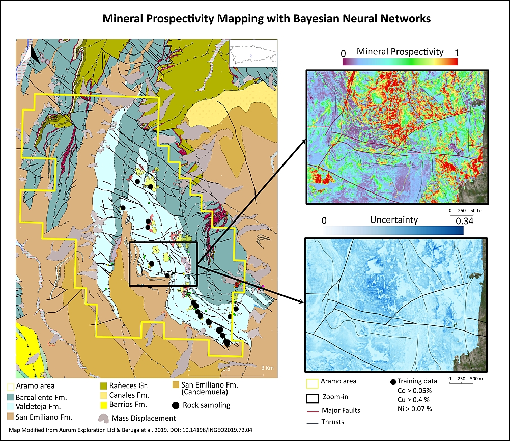
Roberto De La Rosa has focused in S34I in his research on innovative hyperspectral data fusion for enhanced mineral prospectivity mapping. It resulted in a novel, cost-effective, and non-invasive methodology for mineral prospectivity mapping. By integrating hyperspectral data from satellite, airborne, and ground-based sources with deep learning techniques, mineral exploration efficiency was enhanced. Bayesian Neural Networks (BNNs) were utilized to predict mineral prospective areas while providing uncertainty estimates, improving decision-making. To address the challenge of obtaining reliable negative labels for supervised learning, Self-Organizing Maps (SOMs) were used for unsupervised clustering, identifying barren areas through co-registration with known mineral occurrences. This approach was illustrated in the Aramo Unit in Spain, a geologically complex region with Cu-Co-Ni mineralized veins. The developed workflow integrates local geology, mineralogy, geochemistry, and structural data with hyperspectral data from PRISMA, airborne Specim AisaFenix, LiDAR and ground-based spectroradiometry. By leveraging learning techniques and high-resolution remote sensing, exploration can be accelerated, costs can be reduced, and environmental impact can be minimized.
Herewith, you are invited to support the S34I project by filling in your opinion about the developed tools in the Stakeholder Validation Questionnaire until 15th April, latest. The questionnaire intends to assess the use of the prototyped EO analysis-based services in S34I from various potential stakeholders in the mining industry and beyond: