| |
|
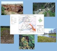
Geohazards
|
|
|
 |
|
-
Soil erosion, landslides, subsidence / settlement
-
Potential for damage in dam catchment areas
-
Detection of the relevant causes of hazards
-
Detection of known damage events
-
Assessment of risks
-
Creation of prognosis maps in high resolution
-
Storage of data in databases and geographic information system (GIS)
-
Supply of data for planning and other projects
|
 |
|
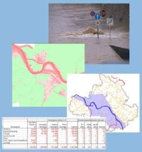
-
Calculation of the flood damage potential down to exact land parcels
-
Visualisation in informative and illustrative maps
-
Maps of input data
-
Maps of results
-
Tables and charts of results with property damage and residents vulnerability
-
Risk prognosis with
|
|